St. Joseph, Michigan Bluff Erosion: Can Your Lakefront Home Rebuild?
October 1, 2026
October 1, 2026
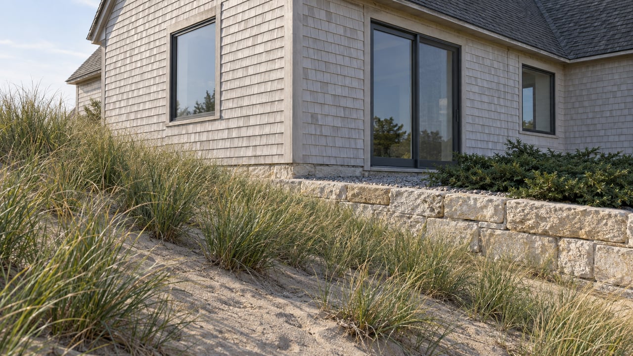
Several lines can matter to a bluff-top lot along Old Lakeshore Drive. One is the property line on the plat map, the one a buyer sees on a survey before closing. Others don't show up on any listing sheet. They're regulatory boundaries, drawn by the state of Michigan and refined by the City of St. Joseph, and they help determine something the view never will: whether the house you're buying can be rebuilt the way it stands now, or whether the next storm resets what's legally allowed on that parcel.
St. Joseph has been managing bluff erosion since long before anyone tried to map its regulatory boundaries. In the 1960s, when Lake Michigan water levels ran high and the bluff along the shore started giving way, a St. Joseph man named Carl Kuyat did what a lot of his neighbors were doing. He pushed junk cars over the edge, using the wreckage as an improvised breakwall against the waves. Washing machines, dryers, bed frames went over too. More than fifty years later, the rusted remains are still down there, a stretch of shoreline locals call the Car Graveyard. It's a strange piece of history, but it's also a preview of everything that came after: when the lake rises, people along this bluff reach for whatever protection they can get, permitted or not.
The names change less than you'd think. Lions Park Beach and Lions Park Drive. Silver Beach. Tiscornia Beach. 2nd Street Beach. Old Lakeshore Drive, where CSX still runs freight tracks along the base of the bluff and has had to shore up sections of roadbed threatened by the same erosion eating into backyards above it.
During the last high-water cycle, homeowners along Lions Park Drive lost enough ground that the city had to act. The Herald-Palladium reported that St. Joseph commissioners approved a license agreement letting residents apply for permits to place rock barriers on city property between their homes and the water, a stopgap while officials worked out something more permanent. The Herald-Palladium reported that a few properties between Silver Beach and Lions Park still lacked any erosion control at all, and the city began considering whether to create a special assessment district to force the issue.
One longtime resident described watching the beach and bluff sand in front of his own house disappear within a matter of seasons. It's the kind of change that makes a regulatory setback line feel less like paperwork and more like the only thing standing between a house and the water.
St. Joseph's zoning code includes something called the Lake Bluff Scenic View Protection Overlay District, laid out in Article IX, Section 9.5 of the city's zoning ordinance. On paper, it's framed as a viewshed protection, limiting how development can block light, air, and sightlines along the bluff, treating that visual access as part of the city's economic health. In practice, it does something more consequential for anyone buying or selling here: it constrains what can go up, and where, on the same strip of land where erosion is already the biggest threat.
Layered on top of that is a stricter zone closer to the bluff edge itself, one the city has drawn more conservatively than the state's own Ordinary High Water Mark or federal flood elevation lines. Inside it, new structures generally aren't permitted at all, with narrow exceptions for things like stairs and unroofed walkways. A buyer comparing two bluff-top listings with nearly identical views can be looking at two very different sets of rebuilding rights depending on exactly where that inner line falls on each lot.
Above the city's overlay sits a state-level designation that carries even more weight: Michigan's High-Risk Erosion Area program, administered by EGLE. A shoreline qualifies as an HREA when it's losing an average of one foot or more per year, measured over a minimum of fifteen years. Once a parcel falls inside a designated HREA, a permit is required for construction anywhere on that property, regardless of how far back from the bluff edge the work is happening. That includes additions, substantial reconstruction, septic systems, even covered porches.
The setback rules inside an HREA are built around projected recession, not current conditions. The 30-year setback line applies to structures that must be readily moveable, meaning they're built to be relocated if the bluff keeps retreating. A 60-year setback applies to more permanent construction. What that means at the offer table is straightforward: two lots with the same frontage and the same view can carry very different building rights, because one sits closer to a line calculated from decades of erosion data and the other doesn't.
| Zone | What's typically allowed | What it means for a buyer |
|---|---|---|
| Outside HREA, outside overlay's restricted edge | Standard construction and rebuilding, subject to normal zoning setbacks | Fewer regulatory surprises when planning renovations or storm repair |
| Inside HREA, outside restricted overlay edge | Permitted construction, but structures near the 30-year line must be readily moveable | Rebuilding after storm damage may require relocating the structure landward |
| Inside the bluff's restricted edge zone | New structures generally prohibited except stairs, walkways | Storm-damaged structures may not be rebuildable in the same footprint |
Some stretches of Southwest Michigan shoreline carry an additional critical dunes designation, a separate state-protected category where EGLE permitting reaches into driveways, decks, and even vegetation removal. It's a reminder that the regulatory line isn't a single boundary. It's several, and they don't always align with each other or with the property line a buyer is used to reading.
None of this is theoretical once erosion reaches a property. Installing a seawall or stone revetment along this stretch of Lake Michigan typically runs $2,000 to $3,000 per linear foot. On a lot with 100 feet of frontage, that puts a full shoreline protection project in the $200,000 to $300,000 range before drainage engineering or any special assessment gets added on top.
Getting permission to do that work isn't fast. According to Lake Michigan Seawalls, minor repairs on an existing structure can qualify for a General Permit from EGLE, typically processed in 30 to 60 days. New installations or larger projects usually need an Individual Permit, which runs 90 to 120 days and sometimes longer if there's public comment. Many shoreline projects on Lake Michigan also require a separate federal permit from the Army Corps of Engineers under the Rivers and Harbors Act, adding another layer of review. From site assessment to breaking ground, a straightforward repair might move in six to eight weeks. A complex new installation with both state and federal sign-off can take six months or more.
Insurance doesn't soften any of this. In neighboring Lincoln Township, WSBT reported that one couple watched their home's foundation disappear over a single winter and learned their insurer wouldn't cover any of it, because the loss came from erosion rather than a sudden, named event. That's the same shoreline, the same lake, the same regulatory logic that governs St. Joseph's bluff.
A bluff-top address in St. Joseph isn't a single product. Two homes a few lots apart can carry very different exposure depending on which side of the HREA line they sit on, how close they are to the overlay's restricted edge, and whether the city has already run erosion control work or a special assessment district past that stretch of shoreline. The listing price and the square footage tell you almost nothing about which situation you're stepping into.
Before writing an offer on a bluff-top property here, it's worth asking whether the parcel has ever been evaluated for HREA status, whether any shoreline protection already in place was permitted or informal, and whether the city has discussed a special assessment district for that block. Those answers say more about what you can actually do with the property over the next ten years than anything in the marketing photos.
If you're weighing a bluff-top purchase in St. Joseph, or trying to figure out what your own erosion control options look like before you list, Brian Waite can walk through what applies to your specific parcel and what it means for your plans. Let's Connect.
This article is general information, not legal, tax or financial advice. Consult a qualified professional about your situation.
Stay up to date on the latest real estate trends.
Brian Waite delivers honest guidance and exceptional service to buyers and sellers throughout Southwest Michigan. From first homes to lakefront properties, he's committed to making every move a success.